مقاطعة سسكس، ڤرجينيا
Sussex County | |
|---|---|
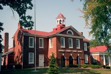
 Sussex County Courthouse | |
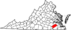
 الموقع ضمن ولاية Virginia | |
 موقع Virginia ضمن الولايات المتحدة | |
| الإحداثيات: 36°56′N 77°16′W / 36.93°N 77.26°W | |
| البلد | |
| State | |
| تأسست | 1754 |
| السمِيْ | Sussex, England |
| Seat | Sussex |
| أكبر town | Waverly |
| المساحة | |
| • الإجمالي | 493 ميل² (1٬280 كم²) |
| • البر | 490 ميل² (1٬300 كم²) |
| • الماء | 2٫6 ميل² (7 كم²) 0.5%% |
| التعداد (2010) | |
| • الإجمالي | 12٬087 |
| • Estimate (2018)[1] | 11٬237 |
| • الكثافة | 24/sq mi (9/km2) |
| منطقة التوقيت | UTC−5 (Eastern) |
| • الصيف (التوقيت الصيفي) | UTC−4 (EDT) |
| Congressional district | 4th |
| الموقع الإلكتروني | www |
مقاطعة سسكس إنگليزية: Sussex County هي إحدى المقاطعات في ولاية ڤرجينيا في الولايات المتحدة.
الجغرافيا
المقاطعات المجاورة
- Dinwiddie County - الشمال الغربي
- Prince George County - الشمال
- Surry County - الشمال الشرقي
- Southampton County - الجنوب الشرقي
- Greensville County - الجنوب الغربي
الديمغرافيا
| التعداد | Pop. | ملاحظة | %± |
|---|---|---|---|
| 1790 | 10٬549 | — | |
| 1800 | 11٬062 | 4٫9% | |
| 1810 | 11٬362 | 2٫7% | |
| 1820 | 11٬884 | 4٫6% | |
| 1830 | 12٬720 | 7�0% | |
| 1840 | 11٬229 | −11٫7% | |
| 1850 | 9٬820 | −12٫5% | |
| 1860 | 10٬175 | 3٫6% | |
| 1870 | 7٬885 | −22٫5% | |
| 1880 | 10٬062 | 27٫6% | |
| 1890 | 11٬100 | 10٫3% | |
| 1900 | 12٬082 | 8٫8% | |
| 1910 | 13٬664 | 13٫1% | |
| 1920 | 12٬834 | −6٫1% | |
| 1930 | 12٬100 | −5٫7% | |
| 1940 | 12٬485 | 3٫2% | |
| 1950 | 12٬785 | 2٫4% | |
| 1960 | 12٬411 | −2٫9% | |
| 1970 | 11٬464 | −7٫6% | |
| 1980 | 10٬874 | −5٫1% | |
| 1990 | 10٬248 | −5٫8% | |
| 2000 | 12٬504 | 22�0% | |
| 2010 | 12٬087 | −3٫3% | |
| 2018 (تق.) | 11٬237 | [1] | −7�0% |
| U.S. Decennial Census[2] 1790-1960[3] 1900-1990[4] 1990-2000[5] 2010-2012[6] | |||
السياسة
Presidential elections results
| السنة | الجمهوريون | الديمقراطيون | الأحزاب الثالثة |
|---|---|---|---|
| 2016 | 40.7% 2,055 | 57.1% 2,879 | 2.2% 110 |
| 2012 | 37.2% 2,021 | 61.7% 3,358 | 1.1% 61 |
| 2008 | 37.8% 2,026 | 61.6% 3,301 | 0.7% 36 |
| 2004 | 43.5% 1,890 | 55.7% 2,420 | 0.8% 35 |
| 2000 | 44.7% 1,745 | 51.4% 2,006 | 4.0% 155 |
| 1996 | 36.3% 1,378 | 55.1% 2,089 | 8.6% 325 |
| 1992 | 35.9% 1,527 | 51.6% 2,193 | 12.5% 533 |
| 1988 | 46.8% 1,822 | 50.3% 1,958 | 3.0% 116 |
| 1984 | 46.1% 2,183 | 50.9% 2,408 | 3.0% 140 |
| 1980 | 38.9% 1,664 | 57.3% 2,447 | 3.8% 162 |
| 1976 | 33.2% 1,360 | 61.0% 2,497 | 5.8% 237 |
| 1972 | 55.0% 2,120 | 42.7% 1,645 | 2.3% 90 |
| 1968 | 29.1% 1,105 | 40.6% 1,541 | 30.3% 1,148 |
| 1964 | 55.4% 1,537 | 44.5% 1,234 | 0.1% 4 |
| 1960 | 35.8% 713 | 62.9% 1,253 | 1.4% 27 |
| 1956 | 39.3% 785 | 42.6% 851 | 18.1% 361 |
| 1952 | 48.0% 888 | 51.7% 956 | 0.4% 7 |
| 1948 | 20.0% 244 | 50.3% 614 | 29.7% 362 |
| 1944 | 20.5% 201 | 78.9% 773 | 0.6% 6 |
| 1940 | 18.2% 164 | 81.6% 737 | 0.2% 2 |
| 1936 | 12.5% 126 | 87.5% 880 | |
| 1932 | 14.8% 122 | 83.4% 688 | 1.8% 15 |
| 1928 | 41.3% 385 | 58.7% 547 | |
| 1924 | 17.7% 132 | 81.3% 607 | 1.1% 8 |
| 1920 | 23.2% 166 | 76.4% 548 | 0.4% 3 |
| 1916 | 16.4% 96 | 82.8% 486 | 0.9% 5 |
| 1912 | 10.5% 59 | 77.5% 435 | 12.0% 67 |
التجمعات
البلدات
تجمعات غير مشهرة
انظر أيضاً
المراجع
- ^ أ ب "Population and Housing Unit Estimates". Retrieved July 14, 2019.
- ^ "U.S. Decennial Census". United States Census Bureau. Retrieved January 5, 2014.
- ^ "Historical Census Browser". University of Virginia Library. Retrieved January 5, 2014.
- ^ "Population of Counties by Decennial Census: 1900 to 1990". United States Census Bureau. Retrieved January 5, 2014.
- ^ "Census 2000 PHC-T-4. Ranking Tables for Counties: 1990 and 2000" (PDF). United States Census Bureau. Retrieved January 5, 2014.
- ^ خطأ استشهاد: وسم
<ref>غير صحيح؛ لا نص تم توفيره للمراجع المسماةQF - ^ Leip, David. "Dave Leip's Atlas of U.S. Presidential Elections". uselectionatlas.org. Retrieved 2018-08-24.
36°56′N 77°16′W / 36.93°N 77.26°W

|
Surry County | Prince George County | Dinwiddie County | 
|
| Southampton County | Greensville County |
الكلمات الدالة:
?
تصنيفات:
- Pages using gadget WikiMiniAtlas
- Short description is different from Wikidata
- مقاطعات Virginia
- Pages using infobox U.S. county with unknown parameters
- Articles containing إنگليزية-language text
- Pages using Lang-xx templates
- Pages using US Census population needing update
- Pages with empty portal template
- Coordinates on Wikidata
- Virginia counties
- Sussex County, Virginia
- 1754 establishments in Virginia
- مقاطعات ڤرجينيا