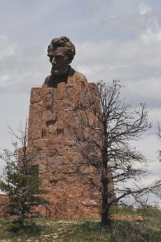
مقاطعة ألباني، وايومنغ
Albany County | |
|---|---|
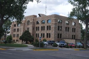 Albany County Courthouse | |
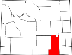 الموقع ضمن ولاية Wyoming | |
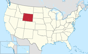 موقع Wyoming ضمن الولايات المتحدة | |
| الإحداثيات: 41°39′N 105°44′W / 41.65°N 105.74°W | |
| البلد | |
| State | |
| تأسست | December 16, 1868 |
| السمِيْ | ألباني، نيويورك |
| Seat | Laramie |
| أكبر مدينة | Laramie |
| المساحة | |
| • الإجمالي | 4٬309 ميل² (11٬160 كم²) |
| • البر | 4٬274 ميل² (11٬070 كم²) |
| • الماء | 35 ميل² (90 كم²) 0.8% |
| التعداد (2010) | |
| • الإجمالي | 36٬299 |
| • Estimate (2019) | 38٬880 |
| • الكثافة | 8٫4/sq mi (3٫3/km2) |
| منطقة التوقيت | UTC−7 (Mountain) |
| • الصيف (التوقيت الصيفي) | UTC−6 (MDT) |
| Congressional district | At-large |
| الموقع الإلكتروني | www |
مقاطعة ألباني إنگليزية: Albany County هي إحدى مقاطعات ولاية وايومنگ في الولايات المتحدة.
الجغرافيا
According to the US Census Bureau, the county has a total area of 4،309 ميل مربع (11،160 km2), of which 4،274 ميل مربع (11،070 km2) is land and 35 ميل مربع (91 km2) (0.8%) is water.[1]
المقاطعات المجاورة
- Converse County – north
- Platte County – northeast
- Laramie County – east
- Larimer County, Colorado – south
- Jackson County, Colorado – southwest
- Carbon County – west
- Natrona County – northwest
المناطق المحمية الوطنية
Major highways
 Interstate 80
 U.S. Highway 30
 U.S. Highway 287
- Invalid type: WY
- Invalid type: WY
السكان
| التعداد | Pop. | ملاحظة | %± |
|---|---|---|---|
| 1870 | 2٬021 | — | |
| 1880 | 4٬626 | 128٫9% | |
| 1890 | 8٬865 | 91٫6% | |
| 1900 | 13٬084 | 47٫6% | |
| 1910 | 11٬574 | −11٫5% | |
| 1920 | 9٬283 | −19٫8% | |
| 1930 | 12٬041 | 29٫7% | |
| 1940 | 13٬946 | 15٫8% | |
| 1950 | 19٬055 | 36٫6% | |
| 1960 | 21٬290 | 11٫7% | |
| 1970 | 26٬431 | 24٫1% | |
| 1980 | 29٬062 | 10�0% | |
| 1990 | 30٬797 | 6�0% | |
| 2000 | 32٬014 | 4�0% | |
| 2010 | 36٬299 | 13٫4% | |
| 2019 (تق.) | 38٬880 | [2] | 7٫1% |
| US Decennial Census[3] 1870–2000[4] 2010–2016[5] | |||
Communities
City
- Laramie (county seat)
Town
Census-designated places
Unincorporated communities
Politics
Owing to the presence of a substantial student body at the University of Wyoming, Albany County voters have selected the Democratic Party candidate in national elections more often than the state as a whole. Since 1892 the county has selected the Republican Party candidate in 63% of national elections (up to 2016).
Presidential election results
| Year | Republican | Democratic | Third parties |
|---|---|---|---|
| 2016 | 44.6% 7,602 | 40.4% 6,890 | 15.1% 2,568 |
| 2012 | 48.3% 7,866 | 45.8% 7,458 | 6.0% 976 |
| 2008 | 46.4% 7,936 | 50.5% 8,644 | 3.1% 537 |
| 2004 | 54.2% 9,006 | 42.8% 7,117 | 3.0% 501 |
| 2000 | 55.2% 7,814 | 35.8% 5,069 | 9.0% 1,268 |
| 1996 | 42.8% 5,967 | 45.9% 6,399 | 11.3% 1,570 |
| 1992 | 32.5% 4,176 | 44.4% 5,713 | 23.1% 2,978 |
| 1988 | 49.9% 5,653 | 48.4% 5,486 | 1.7% 196 |
| 1984 | 60.4% 7,452 | 38.1% 4,708 | 1.5% 186 |
| 1980 | 50.6% 5,830 | 32.7% 3,772 | 16.7% 1,925 |
| 1976 | 57.9% 6,734 | 40.1% 4,663 | 1.9% 225 |
| 1972 | 58.9% 7,021 | 40.9% 4,873 | 0.2% 23 |
| 1968 | 48.7% 4,422 | 44.9% 4,079 | 6.4% 578 |
| 1964 | 32.7% 2,923 | 67.3% 6,019 | |
| 1960 | 50.4% 4,356 | 49.6% 4,282 | |
| 1956 | 55.9% 4,315 | 44.1% 3,407 | |
| 1952 | 59.6% 4,560 | 40.3% 3,082 | 0.1% 10 |
| 1948 | 47.3% 2,858 | 52.0% 3,141 | 0.8% 46 |
| 1944 | 47.9% 2,970 | 52.1% 3,229 | |
| 1940 | 40.5% 2,756 | 59.1% 4,018 | 0.4% 30 |
| 1936 | 32.1% 1,777 | 66.5% 3,685 | 1.4% 77 |
| 1932 | 43.1% 2,281 | 50.4% 2,665 | 6.5% 343 |
| 1928 | 64.1% 2,941 | 35.3% 1,618 | 0.6% 27 |
| 1924 | 47.7% 2,164 | 16.4% 743 | 35.9% 1,628 |
| 1920 | 59.2% 1,769 | 38.3% 1,145 | 2.5% 76 |
| 1916 | 43.8% 1,313 | 52.5% 1,571 | 3.7% 111 |
| 1912 | 32.8% 882 | 38.8% 1,044 | 28.5% 767 |
| 1908 | 49.7% 1,335 | 42.9% 1,152 | 7.3% 197 |
| 1904 | 63.4% 1,674 | 26.7% 706 | 9.9% 260 |
| 1900 | 60.6% 1,540 | 39.4% 1,001 | |
| 1896 | 52.7% 1,220 | 46.4% 1,073 | 1.0% 22 |
| 1892 | 49.5% 1,100 | 50.5% 1,123 |
See also
References
- ^ "2010 Census Gazetteer Files". US Census Bureau. August 22, 2012. Retrieved August 5, 2015.
- ^ "Population and Housing Unit Estimates". Retrieved September 28, 2019.
- ^ "US Decennial Census". US Census Bureau. Retrieved August 5, 2015.
- ^ "Historical Decennial Census Population for Wyoming Counties, Cities, and Towns". Wyoming Department of Administration & Information, Division of Economic Analysis. Retrieved January 25, 2014.
- ^ خطأ استشهاد: وسم
<ref>غير صحيح؛ لا نص تم توفيره للمراجع المسماةQF - ^ Leip, David. "Atlas of US Presidential Elections". uselectionatlas.org. Retrieved April 5, 2018.

|
Platte County | Converse County | Natrona County | 
|
| Laramie County | Carbon County | |||
| Larimer County, Colorado | Jackson County, Colorado |
الكلمات الدالة:
?
تصنيفات:
- Pages using gadget WikiMiniAtlas
- Short description is different from Wikidata
- مقاطعات Wyoming
- Pages using infobox U.S. county with unknown parameters
- Articles containing إنگليزية-language text
- Pages using Lang-xx templates
- Jct template errors
- Pages using US Census population needing update
- Coordinates on Wikidata
- Albany County, Wyoming
- 1868 establishments in Wyoming Territory
- Populated places established in 1868
- مقاطعات وايومنگ


