أريثوسا
Arethousa
Αρέθουσα | |
|---|---|
| الإحداثيات: 40°44.6′N 23°35.4′E / 40.7433°N 23.5900°E | |
| البلد | |
| المنطقة الادارية | Central Macedonia |
| الوحدة المحلية | Thessaloniki |
| البلدية | Volvi |
| • الوحدة البلدية | 214٫929 كم² (82٫985 ميل²) |
| المنسوب | 374 m (1٬227 ft) |
| التعداد (2021) | |
| • الوحدة البلدية | 2٬238 |
| • كثافة الوحدة البلدية | 10/km2 (27/sq mi) |
| Community | |
| • التعداد | 636 (2021) |
| • المساحة (كم²) | 57.021 |
| منطقة التوقيت | UTC+2 (EET) |
| • الصيف (التوقيت الصيفي) | UTC+3 (EEST) |
| Postal code | 570 02 |
| مفتاح الهاتف | +30-2395 |
| Vehicle registration | NA to NX |
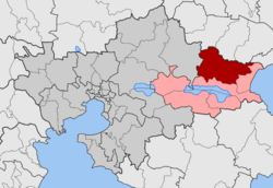
أريثوسا (باليونانية: Αρέθουσα) هي قرية وتجمع ووحدة بلدية في بلدية ڤولڤي.[1] في ثيسالونيكي في اليونان.
في تعداد 2021، بلغ عدد سكانها حوالي 636 نسمة في القرية و 2,238 في الوحدة البلدية.[2] The community of Arethousa covers an area of 57.021 km2 while the respective municipal unit 214.929 km2.[3]
التقسيم الإداري
The community of Arethousa consists of two separate settlements:[2]
- Arethousa (population 564 as of 2021)
- Lefkouda (population 72)
انظر أيضاً
المراجع
- ^ "ΦΕΚ B 1292/2010, Kallikratis reform municipalities" (in اليونانية). Government Gazette.
- ^ أ ب خطأ استشهاد: وسم
<ref>غير صحيح؛ لا نص تم توفيره للمراجع المسماةcensus21 - ^ "Population & housing census 2001 (incl. area and average elevation)" (PDF) (in اليونانية). National Statistical Service of Greece. Archived (PDF) from the original on 2015-09-21.
This article may include material from Wikimedia licensed under CC BY-SA 4.0. Please comply with the license terms.
تصنيفات:
- Pages using gadget WikiMiniAtlas
- CS1 اليونانية-language sources (el)
- Short description is different from Wikidata
- Coordinates on Wikidata
- Pages using infobox Greece place with unknown parameters
- Articles containing Greek-language text
- Populated places in Thessaloniki (regional unit)
- Volvi (municipality)
- مدن اليونان

