إقليم نبراسكا
| Territory of Nebraska | |||||||||||||||||
|---|---|---|---|---|---|---|---|---|---|---|---|---|---|---|---|---|---|
| أرض منظمة مدمجة الولايات المتحدة | |||||||||||||||||
| 1854–1867 | |||||||||||||||||
 | |||||||||||||||||
| العاصمة | أوماها | ||||||||||||||||
| التاريخ | |||||||||||||||||
| • النوع | أرض منظمة مدمجة | ||||||||||||||||
| التاريخ | |||||||||||||||||
| 30 مايو 1854 | |||||||||||||||||
• إقليم كولورادو تتشكل | 28 فبراير | ||||||||||||||||
• إقليم داكوتا تتشكل | 2 مارس | ||||||||||||||||
• إقليم أيداهو تتشكل | 3 مارس | ||||||||||||||||
| 1 مارس 1867 | |||||||||||||||||
| |||||||||||||||||
أرض نبراسكا Territory of Nebraska كانت احدى الأراضي المنظمة المدمجة بالولايات المتحدة التي تواجدت من 30 مايو 1854، حتى 1 مارس 1867، حين أصبح الامتداد النهائي لتلك الأرض جزءاً من الاتحاد كولاية نبراسكا. وكانت أرض نبراسكا قد خـُلِقت حسب قانون كانزس-نبراسكا في 1854. عاصمة تلك الأرض كانت اوماها. وقد ضمت تلك الأرض مساحات مما هو الآن نبراسكا، وايومنگ, ساوث داكوتا، نورث داكوتا، كولورادو، ومونتانا.
التاريخ
| السنة | تعداد | ±% |
|---|---|---|
| 1860 | 28٬841 | — |
| Source: 1860;[1] | ||
An enabling act was passed by the Congress of the United States in 1864. Delegates for a constitutional convention were elected; this convention did not produce a constitution. Two years later, in 1866, a constitution was drafted and voted upon. It was approved by 100 votes. However, a clause in this constitution that limited suffrage to "free white males" delayed Nebraska's entry into the Union for almost a year. The 1866 enabling act for the state was subject to a pocket veto by Democratic Party / War Democrat and new 17th President Andrew Johnson 1808-1875, served 1865-1869), When the Congress reconvened in 1867, it passed another bill to create the new 37th state of Nebraska, on the condition that Nebraska's new proposed first state constitution be amended to remove the suffrage clause. This bill was also vetoed by President Johnson. The then dominant Republican Party-controlled by Radical Republicans in the Congress, then overrode his veto, with the required two-thirds super majority..
الاستيطان المبكر
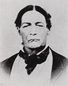
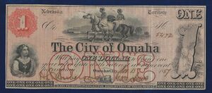
Several trading posts, forts and towns were established in the previous area of the original Louisiana Purchase of 1803, abd the organization of the subsequent Louisiana Territory (1804-1812) and the following Missouri Territory of 1812-1821 (until admission of Missouri as the xx state that year of 1821, in the southeastern corner of the former larger territory. Later decades saw the new Western lands as temporarily unorganized federal territory between the Mississippi River in the east across the Great Plains to the far western Rocky Mountains. That status endured for 33 years from 1821 to the establishment of new official federal territories for Kansas Territory and the one further north in the Nebraska lands, both in 1854.
From the early 19th century through 1867, including Fontenelle's Post founded in the present-day site of Bellevue in 1806. It was first mentioned in fur trading records in 1823. Fort Lisa, founded by Manuel Lisa (1772-1820), (near present-day Dodge Park in North Omaha), was founded in 1812, although Lisa had earlier founded posts further up the upper Missouri River in future Dakota Territory (North Dakota) and Montana Territory (Montana). Fort Atkinson, was founded on the Council Bluff in 1819; in 1822 Cabanne's Trading Post was founded nearby on the Missouri River. Mormon (The Church of Jesus Christ of Latter-day Saints) settlers founded Cutler's Park in 1846, and the town of Bellevue was incorporated in 1853. Nearby Omaha City was founded in 1854, with Nebraska City and Kearney incorporated in 1855. The influential towns of Brownville and Fontanelle were founded that year as well. The early village of Lancaster, (later called and renamed Lincoln), was founded in 1856, along with the towns of Saratoga, South Nebraska City and Florence.[3]
الصحافة المبكرة
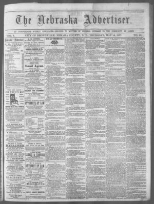
The first newspaper published in the terrain that would become Nebraska Territory and following 37th State of Nebraska, was a weekly military journal stationed at the United States Army post of Fort Atkinson that was published for five years, from 1822 to 1827, before the fort was closed.[4] Thirty years later the Nebraska Territory was being settled and print media appeared serving the dual purposes of sharing the news and promoting the area for further settlement. In 1854, one of the first was the Nebraska Palladium (and Platte Valley Advocate).[4] was the first newspaper to be printed / published in the territory; however, it would last less than a year. These territorial newspapers were efficient but rough and many of the papers folded under quickly changed owners, financial stability or consolidated with other publications. By 1860, the growing Nebraska Territory had twelve weekly publications, one biweekly and one monthly, with a combined circulation of 9,750. After statehood in 1867 the newspaper business expanded greatly.[5]
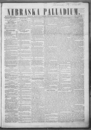
| Pioneer print media in the Nebraska Territory[6] | |||||
|---|---|---|---|---|---|
| الاسم | فترة الطباعة | المكان | ملاحظات | ||
| Nebraska Palladium and Platte Valley Advocate | 1854–55 | Bellevue | Edited by Thomas Morton | ||
| Arrow | Omaha | ||||
| Nebraska News | Nebraska City | ||||
| Nebraskian | 1854–64 | Omaha | |||
| Nebraska Advertiser | 1856 | Brownville | Edited by Robert W. Furnas | ||
| Huntsman's Echo | 1858 | Near Shelton | Edited by Joseph E. Johnson, this paper was influential with Oregon Trail pioneers. | ||
| Nebraska Republican | 1858 | Omaha | The first paper in the Territory to have mechanical presses, this was later succeeded by the Omaha Republican, and in 1871 absorbed the Omaha Tribune. | ||
| Nebraska Farmer | 1859 | Brownville | Robert W. Furnas also published the first agricultural newspaper in the Territory. | ||
| Peru Orchardist | Peru | ||||
| Daily Telegraph | 1860 | Omaha | |||
| Nebraska Deutsche Zeitung | 1861 | Nebraska City | Published by Frank Renner, this German language paper was circulated nationally and in Germany. It is credited with bringing many German settlers to the Territory. | ||
| Daily Herald | 1865 | Omaha | Edited by George L. Miller, this paper was influential in bringing the Union Pacific to Omaha. | ||
المواقع العسكرية المبكرة
With a variety of early fur trading posts, Fort Atkinson, founded in 1819, was the location of the first military post in what became the Nebraska Territory, as well as its first school.[7] Other posts in the Nebraska Territory included Fort Kearny near present-day Kearney; Fort McPherson near present-day Maxwell; Fort Mitchell near present-day Scottsbluff; Fort Randall, in what is now South Dakota; and Fort Caspar, Fort Halleck, Fort Laramie, and Fort Sanders, in what is now Wyoming.
الحدود
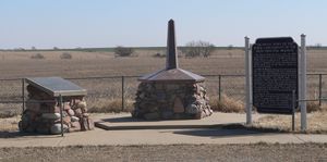
The Nebraska Territory's original boundaries (as specified by its Organic Act) included much of the original Louisiana Purchase; the territory's boundaries were:
- Southern: 40° N (the current Kansas–Nebraska border);
- Western: the Continental Divide between the Pacific and the Atlantic/Arctic Oceans;
- Northern: 49° N (the U.S.–British North America border);
- Eastern: the White Earth and Missouri rivers.
Subsequent territory creation
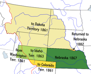
Upon creation, the territory encompassed most of the northern Great Plains, much of the upper Missouri River basin and the eastern portions of the northern Rocky Mountains. The Nebraska Territory gradually reduced in size as new territories were created in the 1860s.
The Colorado Territory was formed February 28, 1861 from portions of the territory south of 41° N and west of 102°03′ W (25° W of Washington, D.C.) (an area that includes present-day Fort Collins, Greeley and the portions of Boulder north of Baseline Road, in addition to portions of Kansas Territory, New Mexico Territory, and Utah Territory).
March 2, 1861, saw the creation of the Dakota Territory. It was made of all of the portions of Nebraska Territory north of 43° N (the present-day Nebraska–South Dakota border), along with the portion of present-day Nebraska between 43° N and the Keya Paha and Niobrara rivers (this land would be returned to Nebraska in 1882). The act creating the Dakota Territory also included provisions granting Nebraska small portions of Utah Territory and Washington Territory—present-day southwestern Wyoming bounded by 41° N, 110°03′ W (33° W of Washington, D.C.), 43° N, and the Continental Divide. These portions had not been part of the Louisiana Purchase; rather, they had been part of Oregon Country and became part of the United States in 1846.
On March 3, 1863, the Idaho Territory was formed of all the territory west of 104°03′ W (27° W of Washington, D.C.).
طالع أيضاً
| بوابة Nebraska | |
| بوابة كولورادو | |
| بوابة North Dakota | |
| بوابة South Dakota | |
| بوابة مونتانا | |
| بوابة وايومنگ | |
| بوابة التاريخ |
- الحرب الأهلية الأمريكية, 1861–65
- مدق كاليفورنيا
- Compromise of 1850
- First Transcontinental Railroad
- Governors of Nebraska Territory
- Historic regions of the United States
- History of Nebraska
- Landmarks of the Nebraska Territory
- الحرب الأمريكية المكسيكية، 1846–48
- معاهدة گوادالوپه-هيدالگو، 1848
- Mormon Trail
- مدق اوريگون
- Territorial evolution of the United States
- Territories of Spain that encompassed land that would later become part of the Territory of Nebraska:
- Nueva Vizcaya, 1562–1821
- Santa Fé de Nuevo Méjico, 1598–1821
- Luisiana, 1764–1803
- Territory of France that encompassed land that would later become part of the Territory of Nebraska:
- Louisiane, 1682–1764 and 1803
- Territory of the المملكة المتحدة that encompassed land that would later become part of the Territory of Nebraska:
- Rupert's Land, 1670–1870
- Territorial claim of the Republic of Texas, 1836–45
- U.S. territories that encompassed land that would later become part of the Territory of Nebraska:
- شراء لويزيانا، 1803–04
- District of Louisiana, 1804–05
- أرض لويزيانا, 1805–12
- أرض ميزوري، 1812–21
- Former territorial claim of the جمهورية تكساس، 1845–1850
- Mexican Cession, 1848
- أرض اوريگون, 1848–59
- State of Deseret, 1849–50 (extralegal)
- أرض يوتا, 1850–1896
- Territory of Washington, 1853–89
- U.S. territories that encompassed land that was previously part of the Territory of Nebraska:
- Territory of Jefferson, 1859–61 (extralegal)
- Territory of Colorado, 1861–76
- Territory of Dakota, 1861–89
- Territory of Idaho, 1863–90
- Territory of Montana, 1864–89
- Territory of Wyoming, 1868–90
- U.S. states that encompass land that was once part of the Territory of Nebraska:
- State of Nebraska, 1867
- State of Colorado, 1876
- State of North Dakota, 1889
- State of South Dakota, 1889
- State of Montana, 1889
- State of Wyoming, 1890
- Territories of Spain that encompassed land that would later become part of the Territory of Nebraska:
- Timeline of Racial Tension in Omaha, Nebraska
الهامش
- ^ Forstall, Richard L., ed. Population of the States and Counties of the United States: 1790–1990. United States Census Bureau. p. 3. Archived from the original. You must specify the date the archive was made using the
|archivedate=parameter. https://www2.census.gov/library/publications/decennial/1990/population-of-states-and-counties-us-1790-1990/population-of-states-and-counties-of-the-united-states-1790-1990.pdf. Retrieved on May 18, 2020. - ^ City of Omaha, Nebraska. "Bank Note, City of Omaha, $1; Scrip, 1857". Lincoln, NE: Nebraska State Historical Society. Retrieved 4 October 2015.
- ^ Federal Writers Project. (1939) Nebraska. Lincoln, NE: Nebraska State Historical Society. p 49.
- ^ أ ب Walter, Katherine. "Nebraska Publishing". Nebraska Newspapers. University of Nebraska-Lincoln.
- ^ Federal Writers Project. (1939) Nebraska. Lincoln, NE: Nebraska State Historical Society. p 134.
- ^ Federal Writers Project. (1939) Nebraska. Lincoln, NE: Nebraska State Historical Society. p 133.
- ^ (n.d.) World Almanac for Kids: Nebraska: Education Archived فبراير 10, 2007 at the Wayback Machine.
وصلات خارجية
- Pages using gadget WikiMiniAtlas
- Former country articles requiring maintenance
- Pages using infobox former subdivision with unknown parameters
- Articles with hatnote templates targeting a nonexistent page
- Coordinates on Wikidata
- إقليم نبراسكا
- Former organized territories of the United States
- تاريخ الغرب الأمريكي
- Pre-statehood history of Nebraska
- Pre-statehood history of Colorado
- Pre-statehood history of Montana
- Pre-statehood history of South Dakota
- Pre-statehood history of North Dakota
- Pre-statehood history of Utah
- Pre-statehood history of Wyoming
- تأسيسات 1854 في إقليم نبراسكا
- 1867 disestablishments in the United States
- States and territories established in 1854
- States and territories disestablished in 1867
- دول وأراضي تأسست في 1854
