بدليس
(تم التحويل من Bitlis)
بدليس
Bitlis | |
|---|---|
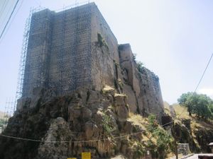
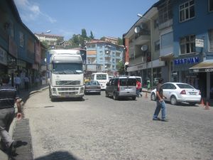
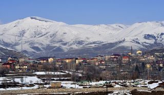 مناظر من بدليس | |
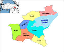 خريطة محافظة بدليس | |
| الإحداثيات: 38°24′00″N 42°06′30″E / 38.40000°N 42.10833°E | |
| البلد | تركيا |
| المحافظة | بدليس |
| الحكومة | |
| • العمدة | حسين أولان (BDP) |
| المساحة | |
| • District | 1٬128٫14 كم² (435٫58 ميل²) |
| التعداد (2012)[2] | |
| • Urban | 46٬111 |
| • District | 64٬725 |
| • كثافة District | 57/km2 (150/sq mi) |
| الموقع الإلكتروني | www.bitlis.bel.tr |
مدينة بدليس هي عاصمة محافظة بدليس يبلغ عدد سكانها 44,923 نسمة ويشكل الأكراد غالبية سكانها.
التاريخ
الإمارة
كانت بدلي إمارة كردية في القرون 13 - 19.
العصر الحديث
المناخ
| بيانات المناخ لـ بدليس (1960-2012) | |||||||||||||
|---|---|---|---|---|---|---|---|---|---|---|---|---|---|
| الشهر | ينا | فب | مار | أبر | ماي | يون | يول | أغس | سبت | أكت | نوف | ديس | السنة |
| القصوى القياسية °س (°ف) | 15.1 (59.2) |
13.2 (55.8) |
23.0 (73.4) |
27.8 (82.0) |
29.4 (84.9) |
34.0 (93.2) |
38.0 (100.4) |
37.4 (99.3) |
35.5 (95.9) |
30.2 (86.4) |
22.0 (71.6) |
15.6 (60.1) |
38.0 (100.4) |
| متوسط القصوى اليومية °س (°ف) | 1.2 (34.2) |
2.3 (36.1) |
6.2 (43.2) |
12.8 (55.0) |
19.3 (66.7) |
25.5 (77.9) |
30.5 (86.9) |
30.8 (87.4) |
26.4 (79.5) |
18.6 (65.5) |
10.4 (50.7) |
3.4 (38.1) |
15.6 (60.1) |
| المتوسط اليومي °س (°ف) | −2.9 (26.8) |
−2.1 (28.2) |
1.7 (35.1) |
7.6 (45.7) |
13.2 (55.8) |
18.5 (65.3) |
22.8 (73.0) |
22.3 (72.1) |
17.6 (63.7) |
11.3 (52.3) |
4.7 (40.5) |
−0.8 (30.6) |
9.5 (49.1) |
| متوسط الدنيا اليومية °س (°ف) | −6.4 (20.5) |
−5.7 (21.7) |
−2.0 (28.4) |
3.2 (37.8) |
7.34 (45.21) |
11.5 (52.7) |
15.6 (60.1) |
15.0 (59.0) |
10.8 (51.4) |
6.3 (43.3) |
0.9 (33.6) |
−4.1 (24.6) |
4.37 (39.86) |
| الصغرى القياسية °س (°ف) | −21.3 (−6.3) |
−22.0 (−7.6) |
−20.3 (−4.5) |
−12.0 (10.4) |
−2.5 (27.5) |
1.9 (35.4) |
7.0 (44.6) |
7.0 (44.6) |
1.8 (35.2) |
−6.0 (21.2) |
−17.0 (1.4) |
−21.9 (−7.4) |
−22.0 (−7.6) |
| متوسط تساقط الأمطار mm (inches) | 148.6 (5.85) |
176.6 (6.95) |
167.7 (6.60) |
167.8 (6.61) |
97.6 (3.84) |
22.8 (0.90) |
5.7 (0.22) |
4.2 (0.17) |
17.0 (0.67) |
89.8 (3.54) |
146.7 (5.78) |
156.7 (6.17) |
1٬201٫2 (47.3) |
| Average precipitation days | 13.6 | 13.4 | 15.4 | 15.9 | 14.2 | 5.9 | 2.4 | 2.3 | 3.5 | 10.2 | 11.1 | 13.2 | 121.1 |
| Mean monthly ساعات سطوع الشمس | 74.4 | 92.4 | 155.0 | 177.0 | 229.4 | 279.0 | 303.8 | 300.7 | 276.0 | 167.4 | 87.0 | 62.0 | 2٬204٫1 |
| Source: Devlet Meteoroloji İşleri Genel Müdürlüğü [3] | |||||||||||||
الاقتصاد
العلاقات الدولية
البلدات التوأم - المدن الشقيقة
بدليس متوأمة مع:
|
الهامش
- ^ "Area of regions (including lakes), km²". Regional Statistics Database. Turkish Statistical Institute. 2002. Retrieved 2013-03-05.
- ^ "Population of province/district centers and towns/villages by districts - 2012". Address Based Population Registration System (ABPRS) Database. Turkish Statistical Institute. Retrieved 2013-02-27.
- ^ http://www.dmi.gov.tr/veridegerlendirme/il-ve-ilceler-istatistik.aspx?m=BITLIS
للاستزادة
- Hovannisian, Richard G. (ed.) Armenian Baghesh/Bitlis and Taron/Mush. UCLA Armenian History and Culture Series: Historic Armenian Cities and Provinces, 2. Costa Mesa, California: Mazda Publishers, 2001.
وصلات خارجية
 "[[s:Collier's New Encyclopedia (1921)/{{{1}}}|{{{1}}}]]". Collier's New Encyclopedia. 1921.
- BitlisHaber13
- Governor's Office
- Bitlis Haber
- BitlisNews
- Bitlis Article on Armeniapedia.org. Bitlis' Armenian history, map and information.
الكلمات الدالة:
This article contains content from Wikimedia licensed under CC BY-SA 4.0. Please comply with the license terms.

