شرناق
Şırnak | |
|---|---|
تجمع سكاني | |
 | |
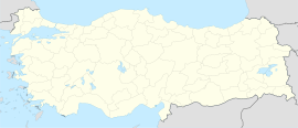
| الإحداثيات: 37°31′12″N 42°27′32″E / 37.520°N 42.459°E | |
| البلد | تركيا |
| المحافظة | Şırnak |
| القضاء | Şırnak |
| الحكومة | |
| التعداد (2023)[1] | 75٬932 |
| منطقة التوقيت | TRT (UTC+3) |
| الموقع الإلكتروني | www.sirnak.bel.tr |
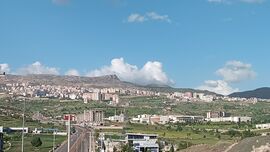
شرناق (Şırnak ؛ كردي: Şirnex)[2] هي عاصمة محافظة شرناق في جنوب شرق تركيا.[3] The city is located near the Ibrahim Khalil border crossing with Iraq, which is one of the main links from Turkey to the Kurdistan Region of Iraq. The city is mainly populated by Kurds of the Şirnexî tribe ويبلغ تعداد سكانها حوالي 75,932 نسمة في 2023.[2][1] It is considered a historical part of Turkish Kurdistan.[4]
التاريخ
In the 9th century AD, during the weakening of the Abbasid Caliphate, several Kurdish emirates were formed. One of which was the Marwanid dynasty, which encompassed the city of Şırnak.[4]
النزاع التركي-الكردي
العملية العسكرية التركية 1992
On 18 August 1992, fighting broke out between Turkish forces and Kurdish separatists of the PKK. 20,000 out of 25,000 residents fled the city during the three days of fighting.
While the town was under bombardment, there was no way to get an account of what was happening in the region as journalists were prevented from entering the city centre, which was completely burned down by the Turkish Armed Forces. Şırnak was under fire for consecutive three days, with tanks and cannons shelling buildings inhabited by civilians.[5]
نزاعات 2014–2016
In the late summer and fall of 2015, following the 2014 Kobanî protests and breakdown of the 2013–2015 PKK–Turkey peace process, which were part of the broader third phase of the Kurdish–Turkish conflict, local Kurdish youth and activists, with some of them being affiliated with the Patriotic Revolutionary Youth Movement (YDG-H), and later YPS, organized popular protests, riots, and declared "self-management" in the city of Şırnak.[6][7] On 13 March 2016 military operations by Turkish forces began in the city against supposed "PKK militants." The military curfew imposed on the city was lifted after 246 days. Neighborhoods such as Gazipaşa, Yeşilyurt, İsmetpaşa, Dicle, Cumhuriyet, and Bahçelievler were completely destroyed during the fighting,[8] with allegations of systematic destruction and human rights violations committed by Turkish security forces.[9] Mehmet Ali Aslan, a lawmaker from the pro-Kurdish Peoples' Democratic Party (HDP), stated that around 50,000 people were left homeless in Şırnak and that “no residential areas remained” following the military operation. He told an investigatory committee that the destruction in Şırnak resembled scenes from Aleppo or cities in the West Bank after visiting the city.[7]
الأحياء
Şırnak is divided into the twelve neighborhoods of Aşağıhan, Atatürk, Aydınlar, Bahçelievler, Boğaz, Cadırlı, Çavuşhan, Hatipler, Nasırhan, Şafak, Yayla and Yeni.[3]
السياسة
In local elections of 2019, candidate Mehmet Yarka of the AKP party won with 61.72% of the vote.[10]
التعداد والسكان

Population history from 1965 to 2023:[11][1]
| السنة | تعداد | ±% |
|---|---|---|
| 1965 | 4٬936 | — |
| 1980 | 10٬997 | +122.8% |
| 1990 | 25٬059 | +127.9% |
| 2000 | 52٬743 | +110.5% |
| 2010 | 54٬263 | +2.9% |
| 2023 | 75٬932 | +39.9% |
Among the Kurdish regions of Turkey, Şırnak is projected to experience one of the highest population growth rates. Today, the province also records one of the highest proportions of residents who identify the Kurdish language, both Kurmanji and Zaza, as their mother tongue.[4]
In 2013 the unemployment rate reached 20.1% in the city, indicating the economic and social handicapping of Kurdish regions by the Turkish state.[4]
المناخ
Şırnak has a hot-summer Mediterranean climate (Köppen: Csa), with chilly, snowy winters and very hot, dry summers. Humidity is always low throughout the year due to its inland location. February and March are the wettest months, July and August are the driest, with virtually no precipitation at all.
Highest recorded temperature:40.4 °C (104.7 °F) on 28 July 2011 and 10 August 2023
Lowest recorded temperature:−14.5 °C (5.9 °F) on 2 January 2009[12]
| بيانات المناخ لـ شرناق (1991–2020، والقصوى 1970–2023) | |||||||||||||
|---|---|---|---|---|---|---|---|---|---|---|---|---|---|
| الشهر | ينا | فب | مار | أبر | ماي | يون | يول | أغس | سبت | أكت | نوف | ديس | السنة |
| القصوى القياسية °س (°ف) | 18.1 (64.6) |
18.2 (64.8) |
24.8 (76.6) |
29.0 (84.2) |
34.1 (93.4) |
38.2 (100.8) |
40.4 (104.7) |
40.4 (104.7) |
38.6 (101.5) |
32.1 (89.8) |
23.0 (73.4) |
22.5 (72.5) |
40.4 (104.7) |
| متوسط القصوى اليومية °س (°ف) | 5.9 (42.6) |
7.4 (45.3) |
12.0 (53.6) |
16.7 (62.1) |
23.0 (73.4) |
30.1 (86.2) |
34.2 (93.6) |
34.0 (93.2) |
29.4 (84.9) |
22.0 (71.6) |
13.5 (56.3) |
8.4 (47.1) |
19.7 (67.5) |
| المتوسط اليومي °س (°ف) | 2.6 (36.7) |
3.8 (38.8) |
8.1 (46.6) |
12.5 (54.5) |
18.7 (65.7) |
25.3 (77.5) |
29.5 (85.1) |
29.3 (84.7) |
24.7 (76.5) |
17.8 (64.0) |
9.9 (49.8) |
5.1 (41.2) |
15.6 (60.1) |
| متوسط الدنيا اليومية °س (°ف) | −0.4 (31.3) |
0.5 (32.9) |
4.2 (39.6) |
8.2 (46.8) |
13.9 (57.0) |
20.1 (68.2) |
24.3 (75.7) |
24.1 (75.4) |
19.7 (67.5) |
13.3 (55.9) |
6.0 (42.8) |
1.7 (35.1) |
11.3 (52.3) |
| الصغرى القياسية °س (°ف) | −14.5 (5.9) |
−13.2 (8.2) |
−11.2 (11.8) |
−4.7 (23.5) |
0.8 (33.4) |
9.2 (48.6) |
13.1 (55.6) |
15.0 (59.0) |
3.2 (37.8) |
−0.5 (31.1) |
−5.0 (23.0) |
−10.8 (12.6) |
−14.5 (5.9) |
| متوسط تساقط الأمطار mm (inches) | 107.3 (4.22) |
103.8 (4.09) |
125.8 (4.95) |
115.1 (4.53) |
52.6 (2.07) |
5.3 (0.21) |
6.1 (0.24) |
0.7 (0.03) |
13.2 (0.52) |
54.6 (2.15) |
82.5 (3.25) |
101.2 (3.98) |
768.2 (30.24) |
| Average precipitation days | 11.29 | 11.29 | 12.81 | 12.05 | 8 | 2.05 | 0.81 | 0.48 | 1.24 | 6.86 | 7.95 | 11.57 | 86.4 |
| Mean monthly ساعات سطوع الشمس | 96.1 | 121.5 | 170.5 | 216.0 | 263.5 | 318.0 | 347.2 | 328.6 | 303.0 | 220.1 | 150.0 | 99.2 | 2٬633٫7 |
| المتوسط اليومي ساعات سطوع الشمس | 3.1 | 4.3 | 5.5 | 7.2 | 8.5 | 10.6 | 11.2 | 10.6 | 10.1 | 7.1 | 5.0 | 3.2 | 7.2 |
| Source 1: Turkish State Meteorological Service,[13] | |||||||||||||
| Source 2: Meteomanz(snow days2017-2023)[14] | |||||||||||||
المراجع
- ^ أ ب ت "Population Of Municipalities, Villages And Quarters". TÜİK. Retrieved 10 May 2024.
- ^ أ ب Baz, Ibrahim (2016). Şırnak aşiretleri ve kültürü (in التركية). p. 114. ISBN 9786058849631.
- ^ أ ب "Türkiye Mülki İdare Bölümleri Envanteri". T.C. İçişleri Bakanlığı (in التركية). Retrieved 19 December 2022.
- ^ أ ب ت ث Repetowicz, Witold (2019). KURDS IN TURKEY. COUNTRY OF ORIGIN INFORMATION UNIT and EUROPEAN UNION Asylum, Migration and Integration Fund.
- ^ Hedges, Chris (30 March 1992). "KURDS IN TURKEY SEEM TO BE NEARING FULL-SCALE REVOLT". New York Times. Retrieved 22 December 2022.
- ^ "Turkey: Mounting Security Operation Deaths". Human Rights Watch (in الإنجليزية). 2015-12-22. Retrieved 2025-10-19.
- ^ أ ب "How the Turkish army and Kurdish fighters reduced this town to ruins". Middle East Eye (in الإنجليزية). 31 January 2017. Retrieved 2025-10-19.
- ^ "246 Days After Curfew and Siege: Sirnak in Photos - KurdishQuestion.com". Archived from the original on 2016-11-17.
- ^ Revolution in Rojava: Democratic Autonomy and Women's Liberation in Syrian Kurdistan (PDF). Pluto Press. 2016. p. 240.
- ^ "Türkiye". Hürriyet Daily News. Retrieved 3 February 2024.
- ^ "Genel Nüfus Sayımları" (in التركية). Retrieved 1 March 2023.
- ^ "İllerimize Ait Genel İstatistik Verileri". mgm.gov.tr (in Turkish). Meteoroloji Genel Müdürlüğü. Retrieved 16 July 2024.
{{cite web}}: CS1 maint: unrecognized language (link) - ^ "Resmi İstatistikler: İllerimize Ait Mevism Normalleri (1991–2020)" (in التركية). Turkish State Meteorological Service. Retrieved 3 May 2021.
- ^ "Sirnak: Weather data by months". meteomanz. Retrieved 16 July 2024.
- تحويل قالب:مقاطعة شرناق
- Pages using gadget WikiMiniAtlas
- CS1 التركية-language sources (tr)
- Short description is different from Wikidata
- Turkey articles requiring maintenance
- Coordinates on Wikidata
- Articles containing كردي-language text
- Articles with hatnote templates targeting a nonexistent page
- شرناق
- أماكن مأهولة في محافظة شرناق
- Kurdish settlements in Şırnak Province
- Provincial municipalities in Turkey
- محافظة شرناق
- مدن تركيا

